La Graciosa
Cruising notes given in good faith, but not to be taken as gospel.
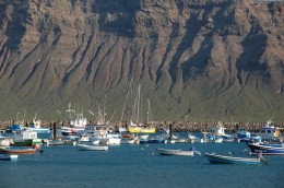
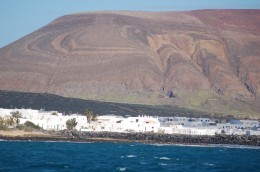
The island of La Graciosa sits at the northern end of Lanzarote and is divided from the mother island by a narrow channel, or “rio” (as the locals term it). The high cliffs off Lanzarote seem almost to overhang the islet and they have a tremendous influence over the weather down here. When the wind is in the south they cause mighty gusts, or williwaws, to go hurtling down onto the channel. At such times, the anchorage on the southern side of La Graciosa is untenable, but in the prevailing northerlies it offers a very good refuge.
The adjacent port (Caleta del Sebo, on the chart) is safe in all imaginable conditions and also has the cheapest marina in the Canaries – but it has no electricity or water, and it cannot accommodate vessels of over 14 metres / 18 tons. Berthing elsewhere within the port is not at all cheap.

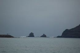
Approaching from the east, the first salient feature of the channel is a rock standing at the foot of the cliffs on the southern / Lanzarote side. It is topped by a white flashing beacon. Further along, on the same side, one finds a white tower. It is the “base” for the smaller island’s electrical needs and marks the narrowest part of the channel (and the position of the underwater cables). The entrance to the port is almost opposite the tower and faces west. Its seawalls feature suitable red and green lights, but they are powered by small solar panels, and unless the day has been a sunny one they will not be shining. The red one seems to keep going for longer than the green. Entering from the east and steering to pass this red light to port would take the vessel straight into the outer wall of the port…
Yes, on the whole it is best not to approach this place in the dark unless one knows the lie of the land.

The anchorage lies in Bahía Salado immediately west of the port. Be sure to give a good offing to the reef which extends from the port hand / westerly side of the port entrance. Even the little open fishing boats give this a good offing. (Note: we have been told that this reef is not marked on the Cmap electronic chart.)
The holding in the bay is good. Landing can be made on the beach.
The waters around La Graciosa are a national park, and we have recently been told that anyone wishing to anchor must now contact the authorities 10 days before their arrival. It is difficult to see how anyone arriving from the Med would be able to do this.
Note also that the shops here are the most expensive in the archipelago. If visiting from one of the other islands, aim to carry all of your supplies with you.
IF YOU VISIT LA GRACIOSA AND YOU FIND THIS INFORMATION TO BE OUT OF DATE, OR OTHERWISE INCORRECT, PLEASE LET US KNOW.
