Cruising in the Canary Islands
Cruising notes given in good faith, but not to be taken as gospel.Herewith, some general notes for the benefit of other visitors.
The information is arranged in the traditional form, beginning with a few paragraphs concerning such matters as history and flora. If you deem these things to be irrelevant to your needs as a yachtsman, just scroll down the page. Eventually you will find the nitty-gritty: an appraisal of the local winds, and a few words regarding local customs… (as in Customs and Excise).
Location
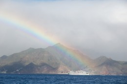 The Canary Islands lie to the north of the tropical belt, close to the desert coast of Northern Africa. As a result of this location they enjoy and endure a variety of climatic conditions, and their terrain varies from arid “bad lands”, which receive an average of one day’s rainfall per year, through to temperate rain forest which is perpetually cloaked and soaked by a cloud. Indeed, these extremes sometimes occur within the same island and can even be found lying within a couple of miles of one another.
Conquest by Spain
Although the ancient Greeks apparently knew of their existence, the Canaries were not much visited by Europeans until the 15th century. It was at this time that the various nations, led by the Spanish and the Portuguese, began to vie with one another for control of the New World. Despite the fact that they were already occupied when they began to take an interest in them, the Spanish had no qualms about conquering and colonising the various Canary Islands, one by one. Until recently it was widely believed that the original inhabitants had been obliterated – even the descendants of those original inhabitants seemed to have forgotten their origins – and thus Spain’s ownership and control of the archipelago has never been brought into question.
Culture
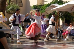 The status of the Canary Islands is similar to that of the various semi-autonomous regions of mainland Spain. They have their own local government and their own tax laws, but the bulk of their legislation is the same as in “the peninsula”. Their language, although spoken with what might be considered a “yokel” accent, has none of the differences of Catalan or Gallego (which are the lingos spoken in two of the Spanish mainland regions).
Despite this apparent cultural similarity, the Canaries have a completely different feel from the mainland, and this is due largely to the different temperament and different appearance of the inhabitants. A true-blooded Spaniard stands out amongst the local people almost as distinctly as a German or a Brit.
Climate
The climate in the Canary Islands is governed by the combination of location and terrain.
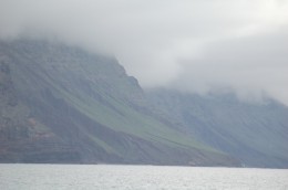 The African desert is only 50 miles away from the more easterly islands and, as a result, the winds which reach Lanzarote and Fuerteventura are relatively dry. Because it receives the brunt of the wind, and because it is quite tall, the northern end of Lanzarote receives what little moisture the air carries, and the rest of this area generally goes without.
The more westerly islands, being twice as far and more from the mainland coast, are caressed by a wind which is correspondingly more humid. In all probability it will have rolled down from the Azores, but even if it is only whistling off the Sahara it will have crossed enough sea to have become moist.
Since they are also very tall Tenerife, La Palma, La Gomera and, to a extent, Gran Canaria, are also capable of recovering more of this moisture than the eastern islands. As it reaches the mountains the wind is forced upwards, and as it ascends and grows colder it sheds its load onto their windward slopes.
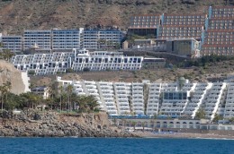 The cloud having been emptied and the wind dessicated, the land to the south of the mountains is caressed only by the sun. Thus it is that one part of an island can be green and damp, and capped by a cloud, whilst just a few miles to the south the ground is parched and barren. Whereas the northern villages are capable of providing a proportion of the islands’ food requirements (in the form of vegetables and fruit) in the south, sun-worshipping tourists are pretty much the only crop.
The prime examples of extreme micro-climates can be found in Tenerife, where the Anaga region presents a stunning contrast to the arid south coast, and in La Gomera, where one can stroll out of the soggy forest and, within the hour, can be walking down a parched, orange-brown barranco.
 The climate in the islands is generally described as sub-tropical, but I think that this implies a greater warmth than one generally finds here. It is true that it would probably be possible to suffer a heatstroke in the month of August – but only if one were hanging out in the holiday resorts on the south coasts of Tenerife and Gran Canaria. The northern coasts of these same islands are seldom overly-hot, and the winter months are a tad too chilly for my liking. However, as long as he remains down on the south coast the visitor is unlikely ever to need a jacket, and unless he goes and stands on the top of El Teíde in the middle of the winter he is unlikely ever to see any snow.
Flora
Because of their relative isolation the islands have a high percentage of unique indigenous plants. The various species have evolved from their mainland equivalents over a period of millennia, and each fits within a particular climatic niche. Thus, on the bare rubble slopes in the south of the islands we find several unique species of spurge (euphorbia) growing in abundance; in the dust by the roadsides we find the “ice plant” – a tiny succulent which appears to be covered in beads of water; and up in the damp rainforest we find the last traces of a type of vegetation known as Laurisilva. This last, we are told, used to cover the entire prehistoric landscape of Europe and North Africa.
Tenerife, La Palma, and Gran Canaria also contain areas of pristine Canarian pine forest, which grows only at higher altitude.
And now we come to the crucial stuff, of most relevance to the visiting yachtsman:
How blows the wind?
The weather, in this part of the world, is governed by the relative positions of the Azores High and the North-West African Low. The winds spin clockwise around a high and anti-clockwise around a low, with the result that, whichever system is predominating, the Canaries tend to get a north-easterly.
When the Azores High predominates, the air is clear and damp and relatively cold, bringing rain to the north coasts and to the high peaks.
When the African Low is in charge, then the visibility is poor (because the wind is loaded with fine particles of sand) and the weather is hot and very dry. The locals know the African north-easter as the Calima, and when it blows they run away and hide in their air-conditioned houses.
It is by no means impossible for the two winds to be blowing at the same time, with the eastern isles receiving a hot dry blast and the western ones remaining a little bit cooler.
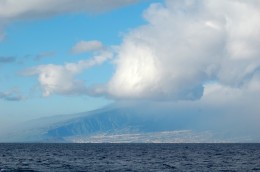 From the yachtsman’s point of view, it makes little odds which north-easter is blowing – just as long as it is blowing. Although the north-easter is certainly the prevailing wind, it is by no means as reliable or predictable as certain cruising guides would have us believe. Indeed, one might say that the ruling factor here is unpredictability.
In our experience the tradewinds frequently fail to reach into this far flung corner of their supposed ambit, and there have been many occasions during our stay when the wind has blown from the north or the north-west. It also blows, occasionally, from the south, the south-west, and even from the south-east – and, contrary to popular opinion, it does this not only in the winter but also in the summer.
To quote a few examples:
In December, while we were heading south from Europe, the wind blew southerly for a fortnight. Its strength varied from near calm to force six, and then from force two to gale force.
In January, while Mollymawk was sailing from La Graciosa to Tenerife, the wind blew from the north-west and then, after a twelve hour period of calm, suddenly gave us a westerly force seven.
In February the north-eastern isles were being swept by a strong, cold northerly, but the southern ones were meanwhile being attacked by another southerly gale bringing in huge swells. (Note that these southerly gales frequently wreak havoc in the marinas on the islands’ south coasts.)
In May the winds were predominantly from the northern sector, but we had a three day period of calm.
In June the winds were, again, predominantly from the north, but we had two days of strong southerly wind.
And so it goes on…
At the time of writing (December) we are expecting a southerly force six.
Acceleration Zones and Wind Shadows
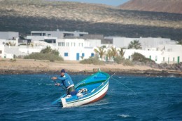 The principal feature of the Canary Islands weather system, and the factor which governs the life of the yachtsman cruising this archipelago, is the network of acceleration zones and wind shadows which form around and amongst the islands.
Since it is a creation of the wind flowing in at the top of the archipelago – or, occasionally, of a wind flowing in at the bottom – this network is far from static. Nor can we be dogmatic and say, “If the wind is in the north-east, and blowing force five, then this particular place will be calm and this area will be gale swept”. However, we can make a few generalisations.
According to our observations :
When the wind is blowing from the north or north-east there will generally be absolutely no wind at all in the lee of the taller islands. Thus, the south coast of Gran Canaria is likely to sitting in a vacuum, and so too the south-west coast of Tenerife. So too the southern region of La Gomera (from San Sebastian round to Valle Gran Rey).
Note that this does not mean that the anchorages in these places will be as calm as a duck pond. On the contrary: it is likely that they will be beset by a swell making its way around the island, and they are quite likely to be rolly. It seems to us that the stronger the tradewind is blowing, the bigger the wind shadow, the mightier the calm, and the bigger the swells driven around the island and into the anchorage.
When the wind is blowing from the north or north-east the channel between Tenerife and Gran Canaria acts as a wind funnel and a steady force five will be whipped into a force seven.
(Note: When I say force seven, I mean a steady force seven – 27 to 30 knots – with gusts of perhaps 40 or even 45 knots. Friends frequently report that the wind “was blowing 45 knots” in this channel, when actually they mean that it was gusting 45.)
The seas generated by this sort of wind will be quite big, and if you are on passage between the two islands they will be meeting you on the beam. Thus, this little trip can sometimes be quite a rough and rolly one.
Other wind acceleration zones include the channel between La Graciosa and Lanzarote, and the channel between Lanzarote and Fuerteventura. We strongly advise that you don’t try coming through either of these in a southerly blow.
When the tradewind is blowing, the wind tends to be accelerated where it has to pass around a headland. The south coast of Tenerife is one example, with the wind frequently picking up to force seven (with force nine gusts) off Punta Roja.
On the opposite side of the channel, the high cape just to the south of Puerto Aldea is often a very wild and windy place, with biggish, breaking seas; and the stretch immediately to the south, between the cape and the headland north-west of Puerto Mogan, is not a lot calmer.
Then again, when the tradewind is taking a break, these places can be mirror flat.
The channel between La Gomera and Tenerife is reputed to be one of the windiest places in the archipelago. Friends who have now crossed it ten times reckon that they have never had less than a force seven here. But we, who on two occasions have crossed it just a day before these same people, have never seen more than a fickle force two to four. On two occasions we found it lying as calm as a millpond!
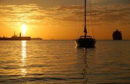 As I said at the outset, unpredictability is the only predictable feature of cruising in the Canaries. When a southerly gale arrives (a thing which seems to happen about once every winter) then the ports on the south coasts are smitten by huge rolling waves which break over their robust seawalls and cause a great deal of damage; but while Mollymawk was being ferried north along the Tenerife-Gran Canaria channel, on the back of a handy force five southerly, the south coast ports which ought surely to have become untenable were still lying in a puddle of calm. Friends anchored, at that same time, in La Gomera and in Arguineguín (GC) did not even know that the wind had gone into the south!
In our experience, the windiest place in the entire archipelago is to be found off the airport in Gran Canaria. We use this as our bench mark. When the forecast says, “Gran Canaria Airport: Gale” then we know that the day is a windy one, but when it says “Gran Canaria Airport: Five” then we know that the trades are not really pumping, and sailing conditions in the channels are likely to be good.
Oh, we like a good romp, but, believe me, you don’t particularly want to be transiting those channels with a force seven on the beam. The seas, hereabouts, are not the same as the ones found in the open ocean. They are short and steep and rather nasty, and they come rolling towards you, tossing the boat onto her beam ends in a most tiresome way.
Weather Forecasts
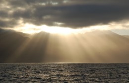 Most folk get their forecast from the internet. Some use PassageWeather (which is nicely presented but, in our view, not very accurate); some use WindGuru; some use AEMet.
AEMet is the Spanish met office, and their forecast (as it is termed) is also promulgated on the VHF. In reality, this broadcast tends to provide a good picture of what happened yesterday, but it does also include a very useful general synopsis from which the weather-literate sailor can form his own conclusions. Listen out on 16 to discover which channel to switch to in order to receive the forecast from your particular location.
The trouble with internet forecasts is that most of them are just computer generated and lack any local input. They might be quite accurate in the short term – they might give a reasonably good view of what will happen tomorrow – but when it comes to predicting what the weather might do in four days time they are pretty hopeless.
Friends who use Passage Weather seem to be forever hurrying to cross from one island to another “before it gets windy next weekend.” Having asked them, afterwards, about these passages, we have come to the conclusion that our friends might just as well have looked at their tea leaves. Or, better still, at the sky.
Seriously: the message is often written in the sky.
Fast moving high cirrus tells you that it is very windy in the channels – or that it soon will be.
Cloud sitting over one of the other islands tells you the same thing (and also means that it is probably not a good day for hiring a car, because your island probably looks just the same).
If you are anchored on the south coast of La Gomera and you can see low cumulus clouds to the west, then – again – you can know that it is windy out there.
Where to go, and When
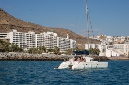 The vast majority of yachtsmen come to the Canary Islands in November and stay for only a fortnight before they set off for the Caribbean. This is a pity, partly because November is not the best month in which to try crossing the pond (since the tradewinds don’t really settle down and blow properly until January) but more specifically because these islands are worthy of a longer investigation.
There really seems to be no good or bad season for visiting. Provided your boat and your crew can cope with a force seven, and provided you watch the weather – and, specifically, provided you don’t let yourself get caught on a south coast in a southerly gale – there is no reason why one should not cruise here in any and every month.
The Facilities
If you need to leave your boat unattended you will want to put her in a marina. La Graciosa is reputed to be the cheapest place to do this – but only if your boat is under 14m.
If you need to slip, there are a number of possibilities. A friend who researched the matter decided that Puerto Mogán was the cheapest.
If you need to do work on your boat and need to buy parts, Las Palmas is your best bet. This is also the best place to stock up for a crossing. The supermarkets here are slightly cheaper than in any of the smaller towns, with a wider variety of produce, and there is also a very good vegetable market. (Good, but nowhere near as good as it used to be 20 years ago, when the vegetables had not been refrigerated. Onions and potatoes which have been stored at room temperature will keep for up to three months on a boat, but those which have been refrigerated will only keep for a couple of weeks.)
Red Tape
Clearing into Spain seems to be virtually impossible these days – and what goes for the mainland goes for the Canaries too.
In our experience, you can ignore instructions in the guide books (to the effect that you can clear into any of the main ports, or that you must get a stamp in your passport if you will be flying out of the islands). Nor is it true that you will need an exit stamp from your last port of call when arriving in the Caribbean or the Cape Verdes. The guys over there are presumably long accustomed, by now, to the fact that the Europeans no longer bother with these procedures.
Alas, the lackadaisical attitude of the immigration officials is not shared by the customs and excise department.
If you are anchored in the harbour of Las Palmas they will almost certainly come and visit you, and they also occasionally drop in on boats anchored off Arguineguín and Puerto Mogán. A second boat patrols the coast at the northern end of Tenerife and we have been approached here, in the dark. (If you detect an unlit boat coming roaring towards you, you can be pretty sure that it is the Aduanas.)
 According to Spanish law, visitors from other EU countries can do as they please for six months, but at the end of that time they are required to import their boat. This is a very, very expensive procedure.
For reasons known only to themselves, the Customs and Excise very rarely enforce this law. We have met people who have been hanging out in the Canaries (or for that matter, in mainland Spain) for years on end, and who claim that there is no threat. You will doubtless meet people who tell you, “Bah! It’s just scaremongering! ‘Betcha can’t find anyone who’s been hit; you’ll just hear about the friend of a friend.” etc, etc.
Well, some friends of ours were hit. Having spent 18 months here they suddenly received a visit from the Aduana and were told that they must pay 15 percent of the value of their boat in customs duty.
(No, it wasn’t a big, fancy boat; it was their home.
No, they hadn’t bought property here, or got jobs (two things which are reputed to “alert” the authorities).
Nobody knows why these people were singled out from amongst the many.)
Note that you can happily leave your boat here, unattended, for as long as you care to; it is your presence which is the crucial matter. According to the law, the owner of a boat can only stay for 6 months in any one year before he is defined as a resident and is required to import the vessel.
For information about anchorages in the Canary Islands, see the following articles:

My goodness, and article from someone who knowns what they’re talking about!
But if you want heatstroke, try August with a south wind coming straight off the Sahara. That’s the weather we had on La Palma when we had the forest fire this year, and I’ve heard it hit 47ºC in El Paso. Not nice, but it usually only lasts a few days.
This is a great peice to read. In September, it will be my first travel in Europe and Spain is the lucky one! Good thing that I found this page so I can have a little know how when I go there. I have on my list is Bonanza Rock which I read as well in https://www.canaryislandsinfo.co.uk/el-hierro/places/, I’m so excited!
Thanks Sheila for this page! Love it! 🙂